
April 10, 2025
Neighborhood Mapping
If you came to the blog to learn more about mapping, this is the article for you!
Two weeks ago--during the last week of March 2025--residents and partners who have been involved in housing initiatives in Church Row and Walnut Neighborhoods were trained in an upcoming mapping survey process.
These mappers will utilize a digital mapping tool called Regrid. You can learn more about Regrid at their website: Regrid: Parcel Data for the U.S. & Canada.
This mapping effort will allow teams focused on housing and structures to confirm the direction of their work and provide meaningful data that shares a snapshot of each neighborhood at a point in time. It will not be shared broadly, but rather specifically shared back with Action Teams as well as any residents who wish to view the data.
Here are a few other important details to note about mapping, directly from the training that we did with mappers.
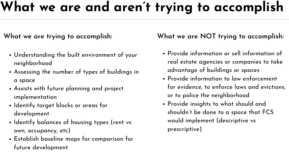
This mapping effort is in partnership by and for residents, and will be helpful as the neighborhood continues in the Flourishing Neighborhood Index process. If you see a mapper, say hello and ask about their passion for your neighborhood!
